Energy
Wind and solar developers tend to know exactly where the best conditions in their region are located. In Alberta, Canada the small town of Pincher Creek is the self proclaimed "wind capital" of the country and they have a solid reason as many developers have attempted to buy up lots and build there. However, with financial lending agencies requiring more and more extensive data to prove your site will make its expected returns GIS and Remote Sensing have become a crucial part of the energy development process. From Site Selection to Hazard Risk Engineering the energy development pipeline of most organizations have come to base many decisions and asset management goals on their spatial databases.
Renewable Energy Site Selection
Every wind and solar developer uses GIS and Remote Sensing when deciding which site will provide the most return for their investment. In general, site locations with greater energy potential and fewer development costs qualify for capital loans with lower interest rates. Further, projects with a steady stream of power production pay their loans off faster than those in less desirable locations. GIS and Remote Sensing help find those locations and meet your organization's other development objectives. Depending on the country and local regulations you will likely identify a number of criteria to weigh against each other when making your final site selection. Choosing these criteria and assessing potential sites is often the first step of the energy development project pipeline and critically impacts the value of the infrastructure.
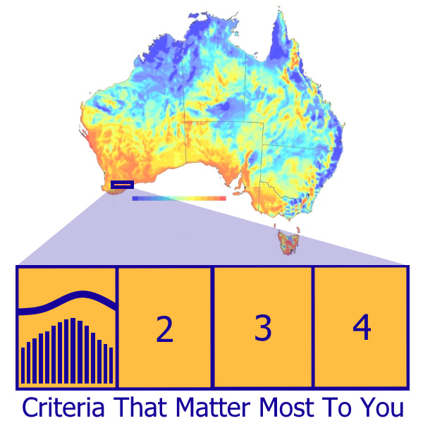
Once you define your criteria for renewable energy sites, data is collected and assessed for how each potential site scores on the scale of succeeding or failing your project's objectives. The spatial data across sites can then be compared and provide the justification your enterprise needs to begin the next phase of your development. Once your final site is selected your enterprise can move forwards and install weather monitoring equipment at ideal locations on the chosen site.
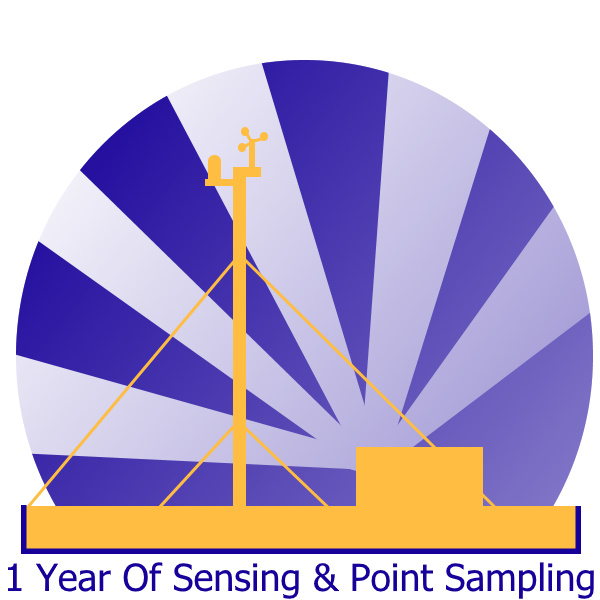
Weather Monitoring for Wind and Solar Energy Sites
Developers build up their GIS and Remote Sensing database by collecting data hourly for a year with wind and solar gauges. This interval of the hour allows consistent measuring which can be aggregated into diurnal energy calculations and mapped across the length of that year. This data is then combined with past decades of data for the area to estimate the energy which could be generated at your site for the next 20-30 years. Lending agencies will use these estimates when deciding what type of loan will be granted to build this project. A well-done weather monitoring scheme will minimize the risk of defaulting on the renewable energy project's loan.
Quantifying Hazards for Wind Energy
For the last 20 years wind energy developers and manufacturers are reaching higher and higher for increased wind power. The higher you go, the more power you get out of each cubic meter of air. Yet, as the wind industry pushes to go higher and higher we're facing a new magnitude of natural hazards. At higher altitudes severe weather comes on quicker and without the normal dampening of energy as altitudes closer to the earth's surface. Now the industry isn't just concerned with how much wind they can harness, but how to avoid areas with high likelihood of hazards and how to build quick-detection systems at these remote wind farms so their facility workers and SCADA systems will be sufficiently prepared to follow the safest protocol possible. While most events can be met with well thought out engineering solutions and staff procedures, or simply insured against the risk, the costs associated with those measures may become too prohibitive for your organization.
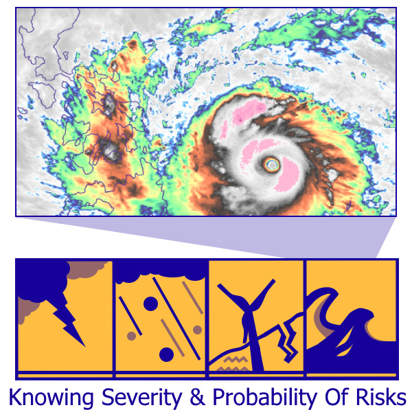
The type of hazards faced in Alberta, Saskatchewan, and the middle of the United States came up with the following list, unique by location considering the same hazards may less severe in other parts of the world:
- Severe winds include category 2 speeds and higher (tornadoes, gusts, etc). These storms tend to carry heavy and large debris which are a hazard to personnel and equipment. Areas prone to this generally have more involved procedures to quickly minimize equipment damage and grid outages.
- Hail storms, with larger thunderstorms producing larger hail projectiles, have a higher chance of damaging equipment. Some locations are prone to storms with individual hail stones sizing from a golf ball to a grapefruit. These site risks may make management and repairs unsuitably costly for exposed energy infrastructure, thus would justify investing in further protective measures.
- Lightning storms have always been a risk to the energy industry with the potential to shut down production. However, with wind and solar facilities powering a higher percentage of our grids these more exposed sites require better storm watching and storm response. This isn't always easy as risky storms can cover huge areas and the likelihood of an actual damaging lightning strike is debatable to the staff who might be operating at the time. Most operators may not think far away storms could affect their high altitude wind production, but the nature of high altitude wind production makes it more vulnerable to strikes which wouldn't otherwise reach the equipment. Lightning with cloud-to-cloud discharges having been measured in North America to stretch in the hundreds of kilometers. Stronger storms have more energy, have the potential for longer distance lighting jumps, and have a risk of greater damage to energy infrastructure. Energy sites with higher probabilities of these large storms require better storm detection and SCADA response systems.
- Mass bird migrations are identified and monitored by biologists. While birds are not as risky of a hazard with a few individuals, when flying en masse they become a more severe hazard. Counts for some of the North American bird migrations record millions of geese, ducks, and other large species flying on a single afternoon's migration survey. These birds are a danger to themselves and energy infrastructure as they often land or fly through at hub height.
- Flooding and soil subsidence affect site layout and civil engineering design. A site prone to washouts requires all critical operation and access infrastructure to avoid or withstand the flooding and subsidence events. While almost every hazard can be engineered against, locations with frequent or severe events become incredibly expensive. The cost can become prohibitive in places like Canada's permafrost lands, Western Washington's wet biomes, Florida's water soluble soils, and Ireland's Peat Bogs.
- Ice storms are common in higher latitudes. These storms are one of the predominant reasons the Scandinavian countries must be extremely careful when choosing weather-protected equipment for their wind energy facilities. However, ice storms can happen anywhere unprotected by Arctic and Antarctic weather movements. As there is a lack of topographic protection in the middle of North America, ice storms come as far down as Missouri, destroying power lines and utility infrastructure with the fast fluctuation in humidity and temperature. To mitigate damage manufacturers are being pushed to set weather ratings for all electronic and mechanical units they may sell. Often these are tested to various environmental ranges with additional weather-proofing for temperature and water. If your potential wind sites are in these large hazard zones then your engineers must be aware to design extra precautions.
These were the sort of hazard assessments created when our analyst worked for the wind energy company and aspiring manufacturer Ampyx Power. Assessments of site suitability and hazardous weather were completed for Australia, Canada, and Europe in 2015. An effort many developers decide to take as knowing the severity and probability of your site's hazards help your Engineers and facility managers protect against them.